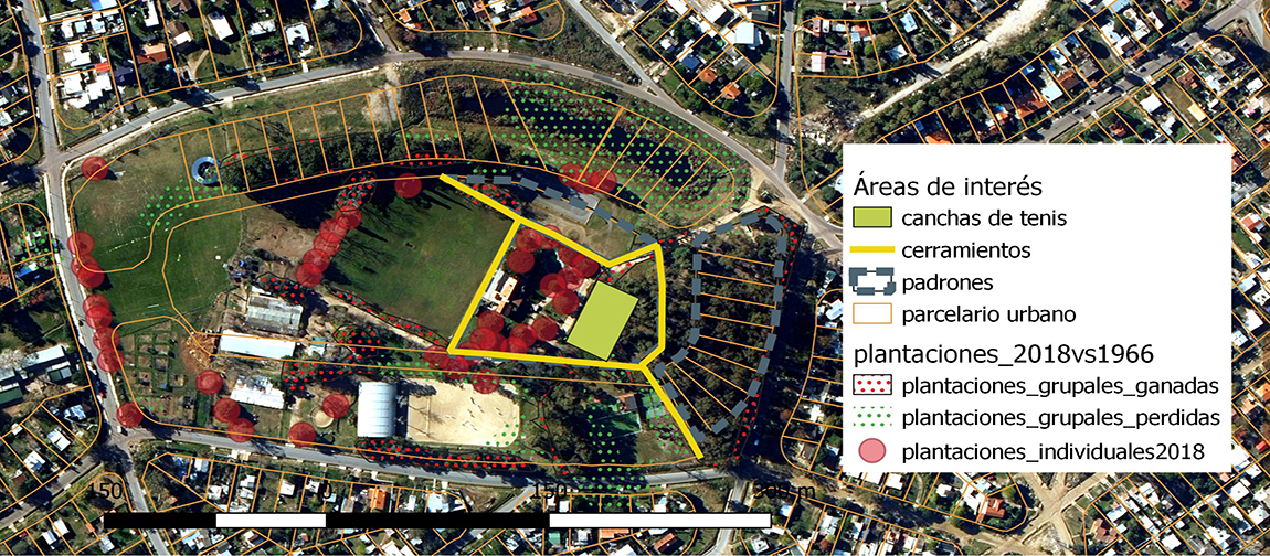
Geomatics to improve decision making
Estate restructure and restoration project. Historical study of plantations based on aerial photographs at different times. Geographic information available on the studied area is processed and consolidated. Its output on the map allows to choose which data to display and in this way the pircture is presented in a simple, fast and complete fashion that facilitates decision making.